- 3D Utility Mapping
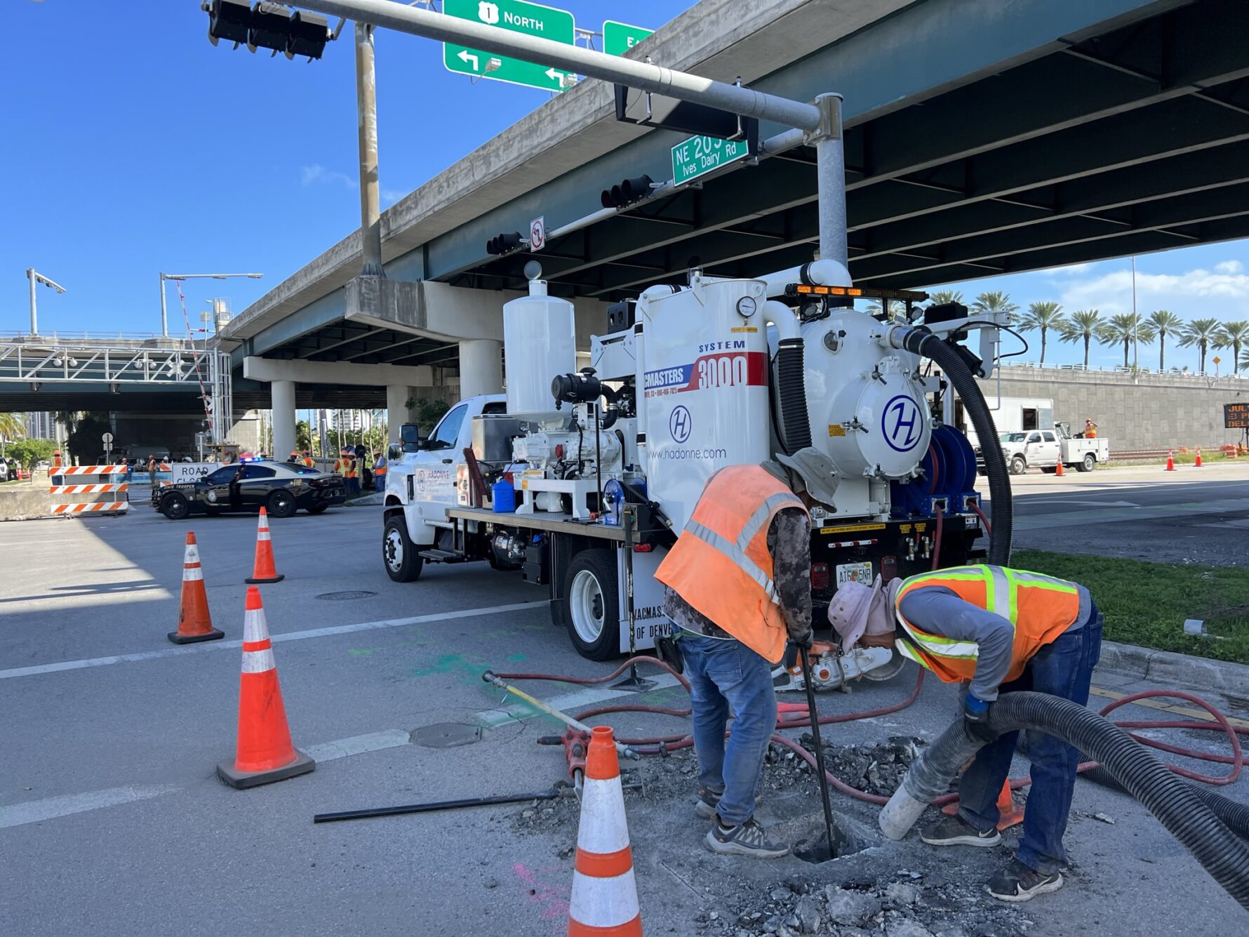
- Air Vacuum Excavation (Test Holes)
- CAD to GIS Migration
- Concrete Scanning
- Digital Data Migration
- GIS Database Design
- GIS Mapping of Underground Utilities
- GPS Field Data Collection
- Ground Penetrating Radar (G.P.R.)
- Private Utility Locates
- Stormwater Inventory and Mapping
- Underground Void Mapping
- Utility Coordination
- Utility Designating
- Utility Inventory and Mapping
- Water and Sewer As-built Survey
- GPS Field Data Collection
- Communication
- Electric
- Fiber Optic Cables
- Gas
- Pipelines
- Sewer
- Voids
- Water
Subsurface Utility Engineering (S.U.E.)
HADONNE offers a full range of Subsurface Utility Engineering (S.U.E.) services to both our public and private sector clients throughout the South Florida area. Our staff of professional utility locators, surveyors, and utility coordinators have the expertise required to deliver accurate utility information needed by clients, consulting engineers, contractors, and designers to make informed project decisions. HADONNE utilizes the latest state-of-the-art vacuum excavation and survey data collection technology including ground penetrating radar (GPR) to obtain the exact horizontal and vertical location of existing utilities in conflict with proposed infrastructure. Our services can be tailored to the project needs, budget, and schedule.
Supporting FDOT Design Consultant: The detailed surface and subsurface mapping of utilities during the planning and design phase of a transportation project will result in considerable time and cost savings during construction. HADONNE is committed to obtaining accurate survey data on the horizontal and vertical location of all existing facilities. HADONNE will provide the clients with a computer-based drawing file and/or hard copy reports of all data collected in the field. This information will aid the design consultant in adjusting their design to reduce if not eliminate costly and timely utility relocation work.
Design Build Projects: HADONNE’s can reduce delays to contractors during highway construction caused by cutting, damaging, or discovering unidentified utility lines. HADONNE’s locating team is composed of damage prevention specialists that average over 6 years of locating experience, resulting in valuable knowledge of utility infrastructure and customer needs. HADONNE can provide “On-The-Spot” locating services to help meet “health and safety” concerns by verifying known or unknown utilities that may or may not be shown on utility drawings or as-builts, as well as locating utilities undetected by the one call system in the area.
Municipal Support: HADONNE can assist county and local municipalities in locating and mapping their above and underground existing facilities including water, sewer, power, gas, and telecommunications lines. In addition to surveying the horizontal and vertical location of the lines, our experienced locators will collect all available data on the type, size, and material. This data collection is the first step in the comprehensive development of any Access Management program by the Utility Agency/Owner.
Private Development: HADONNE provides customized locating and utility mapping services to developers, private institutions, and utility companies outside of the One-Call area.
back to home